Wednesday, December 7, 2016

BBC on Grassland: Planet Earth 2

BBC's new Planet Earth episode on grasslands
David Attenborough has finally brought his dulcet tones to bear on the planet's grasslands in episode 5 of Planet Earth 2. Cue posh public school accent:

"One quarter of the earth is covered by a single, remarkable type of plant . . . Almost indestructible, it can grow two feet in a day and be tall enough to hide a giant."
It is available online for viewers in the UK at the BBC website. Others have found it in other places online but I couldn't tell you exactly where. . . .

My review? Well, it contains the usual stunning imagery and life and death drama you see on BBC nature programs, but if you are looking for north America's grasslands you may be disappointed. There is one short segment on bison and red fox (!?!) in winter on the Great Plains--the rest is shot on other continents.

Here is a bison....


Tuesday, November 29, 2016

WWF report: 53 M acres on Great Plains converted since 2009

a page from the just released WWF "Plowprint Report" for the Great Plains
According to The Washington Post, a report just out from the World Wildlife Fund "argues that the continued expansion of cropland in the region may be threatening birds, pollinators and even drinking water, while releasing millions of tons of carbon dioxide into the atmosphere each year."

WWF data shows that 53 million acres of land in the Great Plains have been converted to cropland since 2009. From 2014 to 2015 alone, approximately 3.7 million acres were lost. 
when native grass is plowed as this was in the summer of 2015, tons of carbon are released

According to the WWF's annual "Plowprint Report" ,published annually to show the loss of grassland habitat, "in 2014, the Great Plains lost more acres to conversion than the Brazilian Amazon."

Where is this happening? Right here in Saskatchewan. In fact, Saskatchewan's White Valley Rural Municipality (Eastend area in the southwest of the province) had the highest rates of habitat loss among regions where there is important grassland bird habitat.

In general, though, as the report says, "the highest rates of loss occurred in the Prairie Potholes Region and specifically in the Canadian portion of that region. The rate of loss in this region is about twice that of the larger study region."

Here are the maps from the WWF Plowprint Report for 2016 (pdfs here for general info and here for facts and figures). Red areas in the map on the left show regions where the rate of grassland loss is highest (Saskatchewan is among the worst) and green in the map on the right shows what remains of native cover on the Great Plains:

Areas of greatest grasslands loss on the Great Plains, courtesy of WWF 


Thursday, November 10, 2016

Grassland Matters--talking to the Canadian Forage & Grassland Association

Baird's Sparrow in a hayfield

Next Wednesday, November 16, I have the privilege of addressing a national gathering of men and women who manage grass.

The Canadian Forage and Grassland Association is hosting its 7th annual conference next week in Winnipeg, Nov. 15 to 17. This is Canada’s only national forage-based conference and will highlight how the forage and grassland sector is a critical foundation for sustainable growth and development throughout the Canadian agriculture industry.

This year's theme is "Grass and Green in 2016" and begins with an optional pre-conference tour to Brandon on Nov. 15 to SG&R Farms and the Manitoba Beef & Forage Initiatives research farm. The main conference includes a trade show, several virtual farm tours, a banquet where the organization presents its New Holland-sponsored CFGA Leadership Award, and a full line-up of speakers on such topics as environmental protection, research at work, sustainable agriculture systems and forage export development.

During my presentation, "Grassland Matters: Some Thoughts on Grassland, Native and Tame, and Why We Need More of It," I will speak about why perennial grasslands, both native and tame, are important not only to the animals that graze them but for everyone; why they are overlooked as lands that must be conserved and fostered; and how producers and consumers, rural and urban, Indigenous and settler people, can work together to conserve, and expand, Canada's grasslands.

While our native grasslands are in trouble, there is an important role for the tame forage community to play in addressing at least some of the issues associated with losing our old growth prairie.

So I will be talking about how not to give up on the life of the prairie that underlies the land no matter what is growing on top—and how the livestock and forage and grassland management world can be part of restoring health to the land.

Looking forward to meeting grass people there!

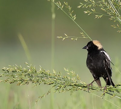
Bobolink on Smooth Brome

Wednesday, November 2, 2016

"The world's most endangered ecosystem"

landscape courtesy of Hamilton Greenwood

"The loss of Canada’s prairies is also a loss for the world."
That is a line from a terrific essay recently posted by Dan Kraus, the Nature Conservancy of Canada's Weston conservation scientist and senior director of conservation program development.

My favourite line in the piece amounts to the strongest statement in favour of publicly owned community pastures that I have seen NCC make to date:

"There is also a key, and immediate, opportunity to conserve large areas of prairie and maintain local ranching economies by protecting community pastures in Alberta, Saskatchewan and Manitoba — public lands that are managed to protect both biodiversity and sustainable grazing in local communities."
Anyway, just read the essay. Dan says it all and says it well.


Bobolink

Thursday, October 20, 2016

paskwâwaskî in October--a book launch

pronghorn, courtesy of Hamilton Greenwood
Sitting on a hilltop last Saturday, watching spiders ballooning through the sky, and above them layers of birds on the move—snow geese in the depths of the blue, with a half dozen canvasback below them moving faster, and then a scattered flock of Lapland Longspurs, like sparks shooting out of a fire and across the whole scene—I thought of all the movement that happens in fall, even in our fragmented prairie world.

There are pronghorn right now slowly moving toward winter range across the medicine line. The Sage Grouse on private ranches near Grasslands National Park will soon do the same, if they haven’t left yet. Montana sage brush, high enough to stay exposed even when snows come deep, will help them survive to breed next spring. And overhead the great flocks of Sandhill Cranes are leaving the northern plains, following their ancient and venerable sky trails to river flats in Nebraska where they will linger as they have for millions of years before continuing south.
sandhill cranes on the move
These are the long truths of the prairie, not the wealth, fuel and roads that let me drive to hilltops and write about it, instead of cleaning out the barn or sorting potatoes the way my grandparents would have in October.

Prairie people once moved in fall too--sometimes by choice, sometimes by force. My mother remembers Metis families travelling down the Qu’Appelle valley at this time of year, stopping to rest at their farm at the mouth of the Kaposvar Creek. Her grandmother called them “gypsies,” after the caravans of Roma people she saw as a child in Scotland. Scottish and English immigrants arriving in the Eastern Qu’Appelle district in the 1880s were welcomed by the resident Metis, who knew well how to winter on the prairie. That first generation of settlers would not have survived without the aid and knowledge of the valley’s Indigenous settlers. What I would give to have been there and heard them talk to one another, across the barriers of language and culture.

Most of the Metis would have spoken Michif, their language blending Cree and French into a unique Indigenous tongue. For the Michif people, and perhaps for the people my mother saw passing by in the late 1930s, the valley was “îwâyatinâk,” the grassland was “paskwâwaskî,” the trail they traveled on by pony and ox-cart was “mîskanâs,” and the stream they rested at was “sîpîsis.”

There is something good about trying to say these words out loud (you can listen to audio samples here of the proper pronunciation), even if we mess up. Why? Because this language is old in the land and has its roots right here where the prairie meets the forests of the northern Plains. 
Norman Fleury teaching in Kamloops
 

As Michif elder, teacher, and language expert Norman Fleury says, “the Michif were Michif before Canada was Canada.” Norman, who traces his Michif lineage back six generations to this land, is featured in my latest book, Towards a Prairie Atonement (University of Regina Press--Regina launch info here), telling the story of his ancestors who lived, farmed, and hunted in a community of 250 Michif people on the Sand Plains near the confluence of the Qu’Appelle and Assiniboine Rivers, until they were told they had to leave in 1938.

Gypsies? No. People of the prairie, and proud survivors of every attempt to remove them from the land. 

If you are able, please join Norman and me and our host CBC's Stefani Langenegger on the evening of October 27th (Royal Saskatchewan Museum, 7 pm; admission free), when we will talk about the new book and the fierce bonds of the Michif to this part of the prairie.

Thursday, October 6, 2016

Understanding the K+S biodiversity offsets

this image shows the footprint of the K+S project, and the grassland lost to build the new solution mine (that is Buffalo Pound Lake in the distance)


This week the Nature Conservancy of Canada (NCC) announced a deal with K+S Potash Canada and the Saskatchewan Government to conserve 402 ha of "high-value grassland", to offset the 194 ha of grasslands that have been degraded and destroyed by a new solution potash mine the corporation built roughly 50 km west of Regina between the Qu'Appelle Valley and the town of Bethune.

Here is the announcement in Canadian Mining Journal

"In 2010, K+S committed to offset natural grasslands affected by the project. But calculating the appropriate offset is not simple. Governments and stakeholders have struggled to create fair compensation schemes that recognize that some habitats are more valuable than others and like-for-like or area-for-area doesn’t necessarily provide the best environmental outcome or use of resources. The formula-based approach tested at K+S’s Legacy mine site estimates functional loss and required offsets using a system of debits-and-credits. The formula includes, among other things, the effect of development on species of concern and the effect of breaking up connected habitat. In the case of the Legacy mine, this means that the 194 hectares of grasslands that have been impacted will be off-set by conserving an estimated 402 hectares of high value grassland."

Much of that is taken from the NCC news release. So, what do they mean by "conserving an estimated 402 hectares of high value grassland"? I wasn't sure so I contacted Cameron Woods, NCC's Natural Areas Manager in the Saskatchewan region who has worked for years on the project (NOTE: the ever-sharp Jared Clarke will interview Cameron on the offset project on 91.3 FM (CJTR Community Radio), "The Prairie Naturalist", this evening, Oct 6 at 6pm. Go online to listen to the show on CJTR here.)

In my message I referred to a story on biodiversity offsets that the NCC posted online last year. Written by Dan Kraus, NCC's Weston Conservation Scientist and Senior Director of Conservation Program Development, the story said, "Offsets are challenging and the line between effective conservation and green-washing can be easily crossed."

I had heard the same concerns, but Kraus's main point in the post was that NCC follows a "net gain" standard on offsets that would mitigate the usual offset issues and "ensure that nature gains ground, natural capital grows and that the good intentions of biodiversity offsets are met."

I asked Cameron if NCC was aiming for that kind of standard with the K+S project. Here is what he said:

"Any project that we plan to undertake in relation to offsets must undergo a rigorous review process to ensure that the objective of a ‘net gain for nature’ is met. In this case, we plan to achieve this net gain by ensuring the permanent protection of native grasslands where we will employ management practices to benefit biodiversity and preserve the functions of grasslands and associated habitats. We will focus our efforts in areas of high habitat connectivity and biodiversity and to ensure the offset can benefit the same species impacted by the Legacy Project. By focusing on these elements and the principles of the Business and Biodiversity Offsets Programme (international collaboration between companies, financial institutions, government agencies and civil society organizations) our goal is to achieve a net gain for nature."

With that in mind NCC will be using the funds from this offset to find 400 ha of private land at risk and with high conservation value.

Now, would it be better if no mine had been built on the 194 hectare patch of grassland displaced by K+S Legacy? Yes, but that was not one of the options open. Meanwhile, the prospect of NCC conserving more than double the hectares of land that is of higher conservation value and then managing it to improve conservation outcomes does help make up for the loss. Will it be no net loss? Even a net gain? Only time will tell but I am sure NCC will work hard to get there.
Mountain bluebirds and many other species of concern could potentially benefit from the lands NCC ultimately uses to offset the grasslands damaged by the K+S Legacy project

Sunday, September 25, 2016

Vote for The Northeast Swale--a new video and website


Unplanned and poorly planned development in Saskatoon is taking its toll on natural areas around the city. The Northeast Swale, a lovely piece of natural grassland and wetland north of the Silverspring neighbourhood, is being placed at risk by two major parkways that the city is planning to build through its heart.

Writer Candace Savage (A Geography of Blood, and Prairie: A Natural History) is part of a growing group of concerned people who want to see a better plan for the swale. The "Northeast Swale Watchers" group has a new website and recently released the video shown above. As their site says, the swale is "a ribbon of wild prairie and natural wetlands that represents the conservation opportunity of a lifetime for the City of Saskatoon."

It's not that there should not be more urban development in a place like Saskatoon--it is a matter of doing it in ways that create a full mix of human-friendly and nature-friendly landscape. With the swale there is an unprecedented opportunity to create a larger, connected greenspace--one that would be the pride of the province. Saskatoon can do this--if you live there, think about it when you vote in the upcoming civic election.

As Candace says at the end of this video, "The best we can imagine is the least we should settle for."

Monday, September 19, 2016

The Government makes it official--the Chaplin Wind Energy Project has been denied


It is time to celebrate--especially if you were one of the 137 people who submitted comments to the Province expressing concerns about the harm that wind turbines could bring to the native grasslands and wetlands around Chaplin Lake.

Today the Saskatchewan Government put out a news release with the following headline:

"WIND ENERGY PROJECT DENIED TO PROTECT MIGRATORY BIRDS"

Thanks to the good work and cooperation of the Saskatchewan environmental community (Nature Saskatchewan, Nature Regina, the Sask Wildlife Federation, Ducks Unlimited, Public Pastures--Public Interest, and many others), the Chaplin project has been turned down and some strong new siting guidelines have been released by the province. Saskatchewan has a chance here to be a leader in ecologically sensitive siting of wind energy projects.

Here is a CBC story on the announcement--more will be on news later today.

Tuesday, August 23, 2016

Saskatchewan Parks—are we taking care of the land or taking care of business?

the view from inside a luxury RV
It  has been a while since I have had some strongly worded responses to things I have written in this space, but the last post about a privately-owned RV park in Sask Landing Provincial Park got almost as many comments as the Wawota quad rally post  last year.

If you want to raise an environmental issue that will elicit some discussion, it seems all you have to do is give your opinion on the ways Saskatchewan people use public land for recreation.

Before I say any more about that kind of use and the privatization agenda that goes with it hand in glove, I have to provide a correction with some new information I have received about that privately owned and managed campground for long-term RV leasing at Sask Landing Park.

In my last post I wrote that some of the campers there were “building decks and extending their site footprint well into the drip-line zone [beneath the cottonwoods]. Within a matter of weeks, the cottonwood grove has gone from a quiet natural area where any member of the public could walk and experience some prairie beauty, to the private tiki-lit domain of a few privileged and high-impact lease-holders.”

Well, it turns out that that is not entirely fair, and overstates things. The campground owner said in his comments that “We have about 10% of our lots with cotton [sic] poplars on them. All potential lessee [sic] had a list of those lots and were well informed no building can happen on the drip zone. I assure you that non [sic] has!”

I have received another report, however, assuring me that there are some firepits under the cottonwoods. A third report said that there were pathways and paving stones being placed under the dripline and people are cutting the grass. Nevertheless, it sounds like disturbance under the cottonwoods is not a serious problem at least in this first summer of the campground bringing in 125 long term lease RVs. 

Therefore, I owe the campground owner, Mr. Bardahl, an apology for jumping to conclusions. I will be more careful.

However, the details of what is or is not happening under one grove of trees is not the main issue here. As Mr. Bardahl points out in his remarks, it is the privatization of our provincial park land that is troubling me.

Why? If you have been going to Saskatchewan Parks as long as I have you will know the problem and its history. A comment I received from a reader who has witnessed a degradation of our parks under privatization and weak regulation sums things up:

“This article really strikes home. My family built a small cabin in Duck Mountain Provincial Park in its early years where there were more stringent limits on development. Green space was much more protected. Cabins were cabins, not four-season mansions. It was accessible and appreciated by people of all income levels. While I grew up, I saw the lake become filled with noise in the summer, the lake got turbid, and the shoreline became dominated by atrocious monuments to wealth. I've seen my neighbours turn from friendly lake people to cold-shoulder suburbanites who use their vacation home for all of three weeks per year. In that time, the quality of park services to the public fell drastically. There used to be several trails - now all grown in and impassible. No organised events or activities for all ages, aside from the usual interpretive programming. The business that runs the general store, cabin/boat rentals and campground store is a joke (but that's another story.) The park favours the rich, through and through. It has lost its mandate to the public.”

The degradation described here began with the neo-liberalism of the early ‘80s. The new Grant Devine Conservative government, following its ideology of reducing government and turning public assets into private ones, started to sell off rental accommodations in provincial parks—in particular, the new facilities at Duck Mountain and Cypress Hills. The buildings began to decline almost immediately under private ownership and the fees rose. Meanwhile funding for ecological programming and maintenance of park infrastructure began to erode as tax-cutting agendas took hold of voters and governments in the late 80s and 90s.

During the NDP era, none of this was remedied and now under the Saskatchewan Party the agenda of saving taxes by cutting environmental protection and providing corporate welfare for private developers has a firm grip on our parks system. Private contractors are often engaged to cut firewood, maintain trails and clean facilities—and the work, when it is done, does not have the same kind of quality control and accountability that comes with a fully funded park system. Compare the state of the trails in our parks to those you see across the border in the United States or in some other parts of Canada and you will know what I mean. Our park staff do the best they can with inadequate budgets but we keep electing the government that promises lowest taxes.

Unfortunately, the same people who want their taxes low also want more RV campsites in our parks. The demand for fully-serviced camping facilities with water, sewer and electrical hook-ups and for long term RV-sites in our parks is on the rise.  For whatever reason, more and more people seem to need to experience nature with a fifth-wheel trailer or motorhome close at hand.  
Cypress Hills Provincial Park Campgrounds . . . how much is too much?


Meanwhile, other campers are complaining about the lack of quiet, natural camping for tents, and feel that RV users are taking over our parks and getting more than their share of park budgets.  These conflicting perspectives both need to be heard, but we have to find ways to meet a wide range of recreation and camping needs without harming the natural heritage of our provincial parks.

Unfortunately, instead of a clear focus on carrying capacity and ecological limits, we seem to have a park system that has thrown open the doors to private business—come one come all. All proposals will be considered—monster home subdivisions, RV lease site campgrounds, golf courses. How about a strip mall? Paint ball anyone?

All of these businesses could be set up on private land but in the new Saskatchewan, developers are learning that costs are far lower if you can set up on publicly-owned land, particularly if there is some water, sewage, road and electrical infrastructure you can piggy-back upon.

I have nothing against RV camping but it is, like hunting or fishing, a high-impact use of public land and likewise requires some limits and strict regulation. We don’t increase the bag limits and numbers of hunters allowed in any given zone of the province just because more people want to hunt; we stick to limits based on what the ecology can bear. It has to be the same with building campgrounds, golf courses, marinas and other kinds of man-made disturbance in our parks.

Do we want to end up with provincial parks that look like privately run tourist operations attached to suburban subdivisions? I would hope that most Saskatchewan people want to keep our parks natural and ecologically healthy, but if we keep privatizing and developing pieces of land to meet the growing demand for of high-impact recreation, the beauty, wildness, and quiet that draws us to our lakes and parks will slowly become layered over in gravel, asphalt, concrete, and paving stones.

Tuesday, August 9, 2016

Get your piece of Saskatchewan: privatizing provincial parks

Saskatchewan has some of the northernmost cottonwood trees on the continent (image courtesy of Wikimedia)
As summer winds down, we may find ourselves looking back on those too few weeks--sad they are ending but happy for the hours we got to spend in the wild and beautiful places all around us.

Thousands of us went to see our provincial parks, from Narrow Hills, Clearwater and La Ronge in the north to Cypress Hills and Moose Mountain in the south. Maybe you walked their trails, paddled their waters, or camped amid the beauty of their grassland valleys or lake-side spruce groves. And if you did, you likely saw lots of other people enjoying the park in their own way. All of this takes planning, work, and regulation to ensure that there will always be public land where we can encounter the world on more than human terms. If you stop for a moment to think about that, you can't help but feel some gratitude that we have a Parks Ministry full of people who go to work every day to sustain our parks and protected areas.

We can be thankful too that the Saskatchewan Party, and Premier Wall in particular, seems to be fond of our parks system--at least the small but increasing portion that is dedicated to cabin subdivisions, RV camping and other things that make nature nice and comfy for us--the service centres, boat launches, water systems, quad trails, picnic tables and barbecues, etc.

The Province has in recent years spent some money to build and fix up such facilities in the core areas of some parks, and has improved camping and access opportunities-- including $2 million for the development of a new, 68 full-service site campground at Greenwater Lake Provincial Park, and an automated campground registration system.

And people are responding--park usage data shows the parks are being used at record levels. But "visitor experience" and turnstile figures only speak to one half of the mandate and mission of our provincial parks. The other side, protection of ecologically and culturally important landscapes, appears to be losing out in decision after decision. The policy balance between visitation and recreation on the one hand and ecological management and protection on the other has always been a struggle for provincial governments of all political stripes, but I think we are seeing a strong tilt in recent years toward increasing access and opportunities for high-impact, resource-intensive kinds of recreation and camping in Saskatchewan parks.

It is happening at parks like Moose Mountain where ATV users are making more inroads each year, gaining access to trails that were until recently for non-motorized traffic only. Across the park system, well-connected, vocal organizations and private business interests seem to be able to persuade policy makers to ignore or circumvent ministry conservation regulations and practices when they conflict with the agenda of providing more subdivisions, more RV sites, and more opportunities for high-impact forms of recreation.

The imbalance in favour of exploitation and development gets particularly wonky when private business interests begin to drive park policy and planning. Last fall, the Parks Ministry announced that it had "struck a deal" with a private company to build a new seasonal camping area at Saskatchewan Landing Provincial Park. Cactus Blume Campground Ltd., owned by John Bardahl (who also owns a home in the park) received a 25-year lease on a piece of the provincial park to run his own private campground business--125 sites large sites, as well as places for boat storage, a playground and laundry, plus electricity, sewage and water.

our public lands are being granted to private campgrounds for long-term camping of RVs

Now I have heard the sad tale that RV people have trouble finding campsites, and on a good day I might be sympathetic to their argument that they deserve more public land where they can park their rigs, store their quads and seadoos, and kick back in front of their big screen TVs for the summer--but does it have to be in a large grove of Plains Cottonwoods, one of the most ecologically significant portions of the park? And even if it had to be put in the cottonwoods, wouldn't it be easier to regulate its ecological impact if the Parks Ministry had built and managed the campground itself?

The stand of cottonwoods in question is one of the only riparian cottonwood ecosystems in Saskatchewan's entire network of parks and protected areas. All cottonwood populations along the South Saskatchewan River--among the most northerly cottonwood ecosystems on the continent--have already been placed at risk by Gardiner dam. Cottonwoods depend on the natural rise and fall of prairie rivers for their reproduction and renewal but the dam flooded out most of Saskatchewan's cottonwood flats fifty-some years ago. Water management for electricity has more or less precluded the kind of healthy fluctuation of water levels that cottonwoods require to stay healthy.

Knowing all of this--and knowing the regulations around siting facilities in sensitive areas--science and conservation staff within the Parks Ministry would have advised against allowing someone to build a campground for 125 RVs in one of Saskatchewan's only protected groves of Plains Cottonwoods.

But Saskatchewan Landing, the closest park to Premier Wall's home in Swift Current, seems to be the testing grounds for sweetheart privatization deals, and it would not be a wild guess if someone were to suggest that the private campground developer might be a Sask Party supporter.

Regardless of the owner's connections--and in that part of the country everyone knows and supports the Premier anyway--the Cactus Blume campground opened this summer and quickly filled with RVs owned by people holding freshly-signed multi-year leases on provincial land.

The Parks Ministry gave strict instructions to make sure that none of the sites encroached on the canopy drip line of the cottonwood trees--i.e. the ground and vegetation directly beneath the outer circumference of each cottonwood's branches was supposed to be left natural and not used by the leaseholding campers as part of their sites. That single restriction, however, has already been tossed aside, and campers this summer have been happily building decks and extending their site footprint well into the drip-line zone. Within a matter of weeks, the cottonwood grove has gone from a quiet natural area where any member of the public could walk and experience some prairie beauty, to the private tiki-lit domain of a few privileged and high-impact lease-holders.

These are good days for people who have the money and connections to get a piece of a provincial park--for those who can afford to lease a subdivision lot or a place for their boat and RV, and especially for those who are able to profit from building private campsites and subdivisions. They come to the Province with these proposals because they know that if they tried to do the same thing on private land they would face higher start up costs and much lower demand for their sites. For a very favourable fee the developer and his customers receive an exclusive kind of access to a piece of the public trust, including the ability to tie-in to water, sewer, roads, and other forms of publicly subsidized infrastructure.

There needs to be an open review of park privatization practices and a publicly accountable mechanism to ensure that carrying capacity guidelines and regulations--those in place and those yet to come--are actually enforced, even when someone fortunate enough to be on the inside of the governing party's circle of friends receives a handshake promise.
the hills at Sask Landing (image courtesy of Branimir Gjetvaj)


Thursday, July 14, 2016

news: Chaplin wind project will be moved somewhere else!


Ferruginous Hawks and other species at risk will fly free on the grasslands where wind turbines were proposed (image courtesy of Brian Sterenberg)
Members of the media at a meeting with SaskPower today were told that the Chaplin wind project will not be approved as proposed. Wayne Mantyka of CTV news followed up with a call to the Premier's Office and they told him that the proponent has been told that they will have to propose another site; that if they persist with this site at Chaplin the Province will have to say no.

A tweet from Mantyka earlier today said, "Algonquin Power told to find different location for proposed Chaplin Wind Farm."

This is tremendous news for Saskatchewan, and a credit to the work of the Saskatchewan Environmental Society, Nature Saskatchewan, Nature Regina, Nature Canada, the Saskatchewan Wildlife Federation, Council of Canadians, Public Pastures--Public Interest and many many others who voiced their concerns about the Chaplin site.

But a voice of concern goes nowhere if there is no one listening. This wise decision comes after countless hours of work by people inside SaskPower and the Saskatchewan Ministry of Environment--public servants who did everything they could to ensure that the public comments would be heard at the highest levels and to provide policy-makers with a full picture of the risks involved in going ahead with such a project. I have met some of these people, and have seen how motivated they are to protect the biodiversity of the province while we transition to alternative energies. They may receive little thanks and will say they were just doing their job, but good decisions like this one do not come without a lot of internal discussion, research, and persuasion. We should all be grateful that the biologists and other staff at SaskPower and the Ministry of Environment took a strong position and that senior staff in the ministers' offices of several ministries gave them a good hearing and made the right call.

This landmark decision bodes well for Saskatchewan's wind energy development plans. The province has an opportunity now to lead the way in proper siting of wind projects, and to set a high standard for the industry to follow.

Tuesday, May 31, 2016

Update on Yancoal: Press Conference at Copper Kettle June 6th

an aerial shot of the Qu'Appelle Valley and Ft. Qu'Appelle Area, courtesy of Wikimedia.org

A Press Release from the QU’APPELLE VALLEY ENVIRONMENTAL ASSOCIATION (QVEA)*

MONDAY JUNE 6TH 10 am

The Leader of the Opposition and Party Leaders from the Green, Progressive Conservative and Liberal parties invited to attend QVEA’s June 6th Press Conference on Yancoal Project.

On June 6th at 10 am at Regina’s Copper Kettle restaurant the QVEA will hold a Press Conference to release its 5-point Position Paper on the Yancoal potash solution mine proposed near Southey.

June 6th is the last day that public comments can be submitted on Yancoal’s Environmental Impact Statement (EIS).

The QVEA has major concerns about the lack of time for public involvement, long-term water security, implications of deep wastewater injection, potash revenues, and the downstream impacts.

The QVEA will be joined by NDP Opposition Leader Trent Wotherspoon, Green Leader Victor Lau, Progressive Conservative Leader Rick Swenson and Liberal Leader Darrin Lamoureux or their designates who will raise their own concerns about the Yancoal project.

The QVEA wants to see a broad-based, multi-party conversation about the need to protect Saskatchewan’s long-term water security as well as protecting the ecologically and recreationally-vulnerable Qu’Appelle Valley.

QVEA organizing committee members Jim Harding, Lorna Evans and Randy Lebell will present the QVEA concerns about the Yancoal Project, the party leaders will be asked to make their own comments, and the press conference will then be open for questions from the media.

For further information contact: Jim Harding - 306-332-4492 or Randy Lebell- 306-331-6231.

*The newly-formed QVEA sponsored the all-party, all-candidates meeting (four parties attended) during the provincial election to discuss the protection of the Qu’Appelle Valley. The QVEA was formed in the aftermath of the huge valley outcry over Regina’s ongoing releases of untreated sewage into the Lower Qu’Appelle.

The Qu'Appelle Watershed, showing all the dams along the river.

Monday, May 30, 2016

Yancoal: more evidence that environmental assessment is not protecting the land

Hey--it is Saskatchewan Mining Week--a time when we can all celebrate the way we let foreign companies dig stuff out of the ground and haul it away leaving a big mess behind.

According to the Fraser Institute’s 2015 Survey of Mining Companies, an annual international survey of exploration, development and mining-related companies, Saskatchewan is the number one jurisdiction for mining investment attractiveness in Canada and the second most attractive jurisdiction in the world. Why? Gee--could it be that we have a government that promises corporations that they will expedite the environmental assessment and approval process?
The Province is right now going through an environmental review of a proposed potash mine for the Southey area north of Regina. Local people are concerned (Western Producer story here) that the design by Chinese coal mining giant Yancoal will harm the loon creek water system and the Qu'Appelle lakes. They say that the water the mine will use from the Qu'Appelle system might well affect Regina, Moose Jaw and all communities drawing water from the Hatfield Valley Aquifer. Yancoal, however, has some experience working with the law to deal with any resistance from local farm people. (UPDATE--there will be a press conference at Regina's Copper Kettle Restaurant on June 6th, featuring leaders of the opposition parties. Details here. Read also this excellent post about Yancoal by Jim Harding.)

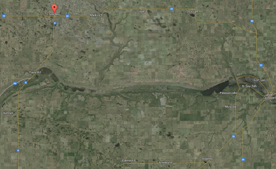
click on image to get larger Google satellite image showing Southey area
and Loon Creek (just left of centre meandering south toward the Qu'Appelle.)


We need to get this right, because once this first Yancoal project is through the chute, there will be more to come. Yancoal says it currently holds 19 potash permits in Saskatchewan, covering approximately 5,364 square kilometres. Saskatchewan could start to look like parts of China where land and water is subjugated to mining and industrial interests.

The following is a guest post by members of the Havelock Special Projects Committee, who live in the area and wants to encourage people from the area and throughout the Qu'Appelle watershed to submit their comments on or before the deadline of June 6th (only seven days remaining!).

Public comments should be sent, either by mail, fax or e-mail to environmental.assessment@gov.sk.ca. Comments must be formalized through written submission and should include your first name, last name and preferred method of contact. 

If you are not emailing then mail or fax to:

Saskatchewan Ministry of Environment Environmental Assessment Branch 
4th Floor, 3211 Albert Street 
Regina, SK 
S4S 5W6 
Tel: 306-787-6132 Fax: 306-787-0930

Here is how the Ministry of the Economy sees Saskatchewan


Here is the post from the Havelock Special Projects Committee:


Abstract

The Ministry of Environment is currently accepting public comment on the Yancoal Southey Project Environmental Impact Statement (EIS). All public comments are due on June 6, 2016. This project raises a lot of questions and everyone with an interest is encourage to submit a letter to the Ministry.
Yancoal Southey Project

The Yancoal Southey Project is a green field mine that will produce potash through solution mining. The Project is located within the subsurface mineral permits KP377 and CP392, west of Highway 6 and north of grid road 731. The project will be designed to produce 2.8 million tonnes of potash per year. The life expectancy of the project is 65 – 100 years (Yancoal.ca).

Yancoal has put forth an aggressive schedule for the project:


2016 – EIS Review, Financial Decision, Environmental Permitting


2017 (Q2) to 2019 – Construction


2020 – Commissioning (Yancoal.ca).

ENVIRONMENTAL CONCERNS
Water Supply

The Water Security Agency (WSA) has indicated that Buffalo Pound Lake is the source Yancoal will draw water from if the project is approved. There is significant public concern about the ability for Buffalo Pound to sustain water demand from existing industries and previously approved potash projects, in addition to the Yancoal project. The WSA does not use climate change forecasts in their modelling. WSA bases the allocation modeling on historical long term averages and annual variability (highs and lows). The risk is high if WSA’s analysis is incorrect and the lake cannot sustain the amount of water it allocates for new mining projects.

Yancoal and the WSA have stated that in case of water shortage residential water needs will take first priority over that of industry. However, the WSA will enter into a contract to supply Yancoal with water, if WSA cannot supply the water then there is potential that the WSA would have to pay Yancoal a penalty fee. Perhaps this penalty clause would be a similar to that SaskPower is paying to Cenovus because they are not producing the volume of carbon they originally agreed to (Plant.ca).
Potential Water Contamination

Yancoal is proposing to drill right through the Hatfield Aquifer. This aquifer is a major source of water for surrounding communities and farmyards. There is no existing solution potash mines over top major aquifers in Saskatchewan. Yancoal assures there will be no contamination to the aquifer and they will monitor closely to see if there are impacts. If the monitoring does detects problems, it will be too late and the water will be compromised. What will surrounding residents and towns do when their water source is compromised? Will Yancoal pay for it? Is there a dollar value that can be put on access to drinking water? Do we trust a huge company to self monitor something as important as our water?

The current natural drainage from the proposed mine area drains into Loon Creek and then enters the Qu’Appelle water system south of Southey and feeds into the Calling Lakes near Fort Qu’Appelle. Once the mine is operational the drainage will contain high levels of salinity which could negatively impact the existing eco-system in the Calling Lakes.

SOCIAL CONCERNS

The host community north of Southey, Sask is a thriving agricultural community. There are a number of young farmers all trying to grow their farms and establish roots in the community. The heritage of family farming is prevailing in this community – other parts of our province are not so fortunate. There are 18 homes and 52 people living in a 2 mile radius of the core facility and 126 homes and 325 people living in a 5 mile radius of the Yancoal project. This is a heavily populated rural area and it appears as though Yancoal did not take that into account when selecting this location. If these people are left to live so close to the mine their health and lifestyles will be negatively impacted. Up-rooting these families will disrupt an otherwise prosperous and content community. The proposed Yancoal mine is not sustainable based on the negative impact it will have on the population surrounding the mine.

CONCLUSION

Allowing Yancoal to proceed with this project, based on the way they have developed this project to date is setting the bar far too low. If Yancoal is allowed to get away developing a major project using the business practices they have then the Province will be opening the flood gates for further unfavorable developers. Yancoal was not aware of how to properly do business in Saskatchewan when they started this project. They have divided the community, they have exposed residents living nearby to undue stress and uncertainty about the future, and they have added a huge burden financial burden to the RM which they have not agreed to reimburse. The Ministry of Environment needs to be made aware of the concern this project conjures up with the public. The best way to do that is to make your concerns known and your voice heard by submitting a letter to the Ministry by June 6. If you would like more information on the impacts this project has already had in the community and the environmental concerns that still need to be addressed, please follow Havelock Special Projects Committee on Twitter or Facebook.

Wednesday, May 25, 2016

A trip to see Species at Risk at Chaplin grasslands

on Saturday, a team of birders made a rough survey of birds at grasslands slated for
wind development north of Chaplin Lake
In the coming weeks we will almost certainly see the Saskatchewan Government approve Algonquin Power Company's wind project four and a half kilometres north of Chaplin Lake.

That setback distance is the minimum required from a major wetland like Chaplin Lake, and we will perhaps in years to come learn how the shorebirds and other waterbirds who use the wetlands in the area are being affected by the installation of wind turbines.
However, as I mentioned in my last post, the decision to site 24 turbines on native prairie is the biggest single threat posed by this wind energy development.

Those hills of native grassland support an array of wild animals whose tenuous efforts to breed and rear viable young will be hurt by the introduction of massive vertical structures in their home ranges.
Instead of unbroken native range and open skies above, the landscape will be dominated by a network of 24 wind generators filling the sky. And the sky matters. For hawks and aerial-displaying birds like the pipit and long-billed curlew, open sky with no vertical structures is habitat. Each turbine site will have a gravel pad footprint where the native cover is removed. As well there will be an electrical substation, a web of new electrical collector lines, and new roads into each site and connecting one to the other.

Click on this link to see a short (and windy!) video of the native grass-covered hills that will soon fill the air with turbines instead of hawks and pipits. 

So, how many hawks, curlews, pipits and other vulnerable birds breed in this landscape that will be damaged by Algonquiin's wind project? Stantec Consulting Ltd., the "environmental consultants" who conducted the environmental impact research work and wrote the Environmental Impact Statement for the proponent, did some breeding bird survey and amphibian surveys from 2012 onward.

Here is a map from the EIS document--but it merely shows a few of their records:


More significantly, here is a table from the Wildlife Technical Review, Appendix d4 of the EIS. It shows that their field survey's in 2014 turned up 672 individuals of 15 different vertebrate "Species of Conservation Concern," including Species at Risk.


672 creatures, many of whom will not be able to co-exist with the linear and vertical structures soon to come to their neighbourhood.

One odd thing about this list is the low number for Ferruginous Hawk. Local naturalists will testify that this is an important area for both Swainson's and Ferruginous Hawks.

Last Saturday, I joined a team of four other birders to do a quick survey of hawks and other birds currently using the native grassland slated for wind development north of Chaplin.

It was an informal effort and we spent less than two hours, surveying a small subset of the total grassland area to be affected.

We stayed on the few public roads that give limited access to the land, stopping at intervals to listen and watch for birds. Our hearing was limited by 70 kilometre per hour winds, which also would have suppressed bird song. Nonetheless, we heard Sprague's Pipits at three stops, and saw a pair of Lark Buntings.  Along one road we found a small group of Sharp-tailed Grouse. But it was the large hawks that dominated the landscape.

Swainson's and Ferruginous hawks seemed to be on every horizon. We counted eight Swainson's, all recently arrived from their winter in Argentina, and we saw five Ferruginous--a very high number especially with our limited access to the property.

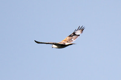
Here are two shots of Ferruginous Hawks, taken by Brian Sterneberg on Saturday morning.


Stantec had this to say in the EIS about birds and bats they recorded in native grassland:

"During bird surveys, five sharp-tailed grouse lek were recorded and the LAA ["local assessment area"] was found to be used during nocturnal shorebird movement. Breeding birds observed include Baird’s sparrow, bobolink, chestnut-collared longspur, sharp-tailed grouse, Sprague’s pipit, and barn swallow. Bat species were also identified in the LAA including: eastern red, hoary, long-eared, silver-haired, western small footed bats, little brown myotis and big brown bat."

That is a lot of species depending on the habitat, and yet Stantec's very next sentence states, without any substantial rationale, that the project's "residual environmental effects" on these species "were predicted to be not significant." Huh?

The Ferruginous Hawk and Sprague's Pipit have already lost most of their native grassland habitat on the northern Great Plains, and have demonstrated quite effectively that they disappear from an area when the habitat is significantly altered by agriculture and other kinds of industrial activity.

The hawks we saw on Saturday were flying over the hills; the pipits were also high up in the air. They were not on fenceposts or foraging at the side of the road. Pipits don't do that. These tiny songbirds were aloft, a couple hundred feet above us, in courtship flightsong, marking the boundaries of their territories. For a pipit, a bird known to remain at this height for an hour or more at a time, the air is a significant portion of its home range.

Ferruginous hawks use the space above native prairie to hover as they hunt for their prey, ground squirrels. The first three hundred feet of space above the prairie is almost as vital to a pipit or a Ferruginous hawk as the grass below. Once this aerial habitat is overtaken by dozens of three-hundred foot high turbines with one-hundred foot long blades slicing through the air, these birds so accustomed to the sky and grass dynamic of prairie will lose their breeding grounds. We can do all the mitigation and monitoring in the world after the destruction, but it will do nothing to help them to remain and breed successfully.


The proponent will talk about remaining a certain distance from nesting sites of Species at Risk, but for a bird like the Sprague's Pipit, it is doubtful that surveyors, no matter how skilled or diligent, would find even a small percentage of their nests. Most of those 62 hectares is prime pipit habitat and there are likely pipits nesting on most quarter sections.

Where is our protection for endangered species in this country? Can someone please remind me why Canada has Species at Risk legislation? What good is it if a provincial government, acting through its Crown Corporation can sponsor the destruction of 62 hectares of habitat for officially listed species?

There are thousands of wind-swept acres a short distance north, east, and west of the islands of native grassland that SaskPower, the Saskatchewan Government, and Algonquin Power have in their sights--places that lost their pipits and Ferruginous hawks decades ago when the ancient sod was plowed.

When a government is so irrationally and without any satisfactory explanation attached to a site that is clearly a disastrous and unpopular choice, can you blame people for speculating that someone shook someone's hands on a deal we will likely never hear about?

Saskatchewan needs plenty of well-sited wind energy projects to be sure, but this is not the way to proceed. It won't do to destroy native grassland for this project and then write some toothless guideline document that will be filed on government shelves and ignored whenever it is expedient to do so.

We need to stop the government-sponsored destruction of native grassland now, while the air above the Chaplin prairie hills is still flush with song and the hovering of hawks.

Once that is done, we need something more than wishy-washy guidelines to ensure we have no more Chaplins in our future. We need to legislate and enforce strong, binding regulations on siting wind energy projects that all proponents and government agencies will have to follow.

Anything less will turn Chaplin from a cautionary tale into a dangerous precedent and more native grassland ecosystems will be degraded and destroyed by wind energy projects.


Friday, May 13, 2016

Chaplin Wind Project will be going ahead

the 79 turbines planned will be directly north of Chaplin Lake,
one of Canada's Eight Hemispheric Shorebird Reserves

The Saskatchewan Ministry of Environment received an unprecedented number of submissions, 137 in fact, expressing concern and alarm over the proposed wind energy project north of Chaplin Lake, including strong statements from the Saskatchewan Environmental Society, Nature Canada, and other conservation groups.

Regardless, all indications are that the Chaplin project will be going through more or less as planned, with 79 turbines 4.5 kms straight north of the lake. Even more disturbing, 24 of them will destroy most of 62 hectares of native grassland. The 4.5 km setback from the wetland is right on the borderline of recommended setbacks and may still prove to be a source of embarrassment for the Province if a great many bats and birds are killed by the turbines, but for now the decision to site 24 turbines on native prairie is the biggest single threat posed by this wind energy development.

Besides the footprint of each turbine and its gravel pad, there will be roads with a lot of truck traffic going to and from the installations. Though many transmission lines will be buried (which will also introduce weeds and fragment the native grassland), there will be some aerial transmission lines along roads. With species at risk such as Ferruginous Hawks nesting and hunting ground squirrels in the area, all of these forces degrading the habitat should be enough to force any responsible government to move the 24 turbines off of native prairie.

Ferruginous hawks depend on the grasslands north of Chaplin Lake 
(image courtesy of Hamilton Greenwood)

Instead, we are expecting that any day now Minister Herb Cox will announce his approval of the project more or less as is.

His own people, biologists and others inside his ministry, have no doubt advised him to move the project off of native grassland but their advice is falling on deaf ears. Within the political limits imposed by the Minister--i.e. the project must be approved and no turbines will be moved off native grass or farther away from the flight paths of Chaplin Lake's teeming bird life--public servants in the ministry have very likely been scrambling to come up with some way to reduce the harm of this egregiously bad choice for siting a major wind project.

Thanks to their hard work, there will likely be some mitigation and monitoring measures announced with the approval decision. Unfortunately, as the ministry's biologists know better than anyone, mitigation and monitoring after you have sacrificed the habitat is never enough to make up for the disruption and degradation caused by such a development.

The proponent, Algonquin, will want to hire its own consulting engineering company to do the monitoring--someone like Stantec--because they know that a consultant they hire is unlikely to find any data that would require them to shut down or move turbines. That kind of self-regulation, with poorly designed data-gathering models and often unqualified researchers, is unacceptable in a development this controversial.

If the province really wants to show us that they are doing their best to protect the bats and birds, and finding ways to site wind projects properly, they should make the proponent secure truly independent monitoring by researchers from a university or some other third party organization.

If the Chaplin project goes ahead--and all indications are that it will--the Province needs to ensure that real scientists with no connection to the proponent are engaged to design, conduct and oversee studies that are legitimately aimed at figuring out the impacts of putting up so many turbines on native grassland and north of a world class shorebird reserve.

Wednesday, May 4, 2016

Swans killed by energy infrastructure this spring

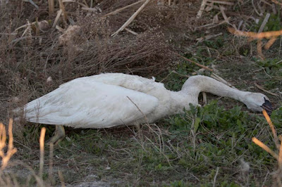
Trumpeter swan killed by transmission lines at Frank Lake (photo by Mike Sturk,
see below for more images)

We are an energy-intensive civilization and whether it is solar and wind or oil and gas, gathering the kind of power we use every day seems to require a lot of man-made infrastructure on the landscape. With the decision on the Chaplin Wind Project looming (the Environment Ministry has called a meeting on May 9th, inviting a select group of conservation NGOs who commented on the Environmental Impact Statement), some news out of Alberta provides a powerful cautionary tale.

While the turbines themselves have to be sited on disturbed lands with little ecological value, this story from Alberta demonstrates that is important to ensure that the associated transmission facilities carrying the electricity away are also sited carefully.

The following story showing that transmission lines are killing Trumpeter swans at Frank Lake Alberta, is based on a report by (and presented here with the permission of) biologist Greg Wagner, one of Alberta's most vigilant defenders of prairie habitats. A big thanks to Greg for bringing this issue to public attention and for letting his words appear in this post.

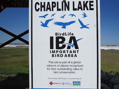
Frank Lake is, like Chaplin Lake in Saskatchewan, a recognized Important Bird Area. Greg says that it is one of the few Environmentally Significant Areas in the Municipal District of Foothills

It is also a major Ducks Unlimited Canada project, built with funding under the North American Waterfowl Plan. It is arguably the single most important bird habitat area south and west of Calgary.

The lake is also used as a major spring and fall staging area by both Tundra and Trumpeter Swans as highlighted on eBird, which is publicly accessible online. This data also shows that Basin 2, and to a lesser extent, Basin 3, are the most important areas on the lake for spring and fall staging swans. The number of staging Trumpeter Swans has also increased significantly over the last decade as the migration route of this species has expanded eastward.

Despite the areas importance for wildlife, AltaLink has recently built new transmission lines around the lake. These lines, along with historic lines now surround the western half of the lake. It is well known that transmission lines can act as large mortality sources for habitat areas that are used by large numbers of birds such as wetlands like Frank Lake (e.g., Crowder and Rhodes 2001, Rioux et al. 2013). Large less maneuverable birds, with heavy wing loading, like swans, cranes, pelican and herons, are know to be particularly susceptible to transmission strikes, particularly to single top wires.. Both the Alberta Trumpeter Swan Recovery Plan 2012-2017  and the most recent Alberta Trumpeter Swan Status Report indicate that 

"Electrocution and other injuries from collisions with power lines are believed to be the most significant causes of mortality for adult trumpeter swans in Alberta. The Grande Prairie area appears to have the highest recorded number of mortalities with as many as 6-10 confirmed cases each year.” 

Beyersbergen et al. 2009 also observed the following related to the large nesting colony (up to 50,000 pairs) of Franklin’s Gulls at Frank Lake: "There is a large power-line intersecting the colony on Frank Lake. While performing nest counts on the lake, we noticed a number of dead gulls directly under the powerline. No mortality counts from the power-line were conducted so we do not know how many birds die each year due to collision with the line and towers.”

Given the amount of information available on the impacts of transmission lines around wetlands, it is somewhat incredible that transmission lines would be built so close to the lake. The line at the southwest corner of the lake could actually have been set back further from the existing line, which it will replace. Instead it was built closer. Reflective tags have been put on the top wire of the new transmission lines as a means to mitigate collisions. But it is unclear how effective these have been given current mortality levels. AltaLink also conducted radar and visual surveys in tandem on Basin 1 on September 30, and October 12 and 18, 2013 (Stantec 2012). Unfortunately, these studies were done on Basin 1, which receives minor swan use relative to Basin 2, and were done before large numbers of swans arrive at the lake.

Furthermore, it isn’t like there are vast amounts of wildlife habitat in the High River area. Frank Lake is more or less it. The lake could have been easily avoided by transmission line development. After all, the first rule of environmental management is to avoid potential impacts where feasible. It was certainly feasible to avoid putting transmission lines near Frank Lake in this case.

Known swan mortality at Frank Lake over the last two years is as follows:

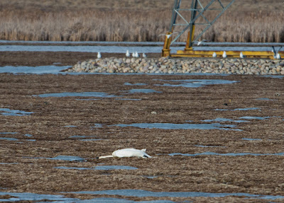
  • 19 March 2015, three carcasses found under transmission line at basin 1 of Frank Lake. These all appeared to be Trumpeter Swans, but this could not be confirmed because the carcasses were lying on thin ice (see attached pictures taken by Mike Sturk ). A Snowy Owl carcass was also found under the transmission line (See page 15 of this issue of the Western Producer)
  • Two splashes of white feathers, including large primaries, with no carcass present were found near the blind at Basin 1 in Spring 2016 before 4 April. Another splash of white feathers, with no carcass present was also found under the transmission line on the north side of Basin 1 at this time. Splashes of white feathers were found around all other carcasses at Frank Lake.
  • 4 April 2016 – one Trumpeter Swan found dead under the transmission line at basin 1 west of the blind (see article from High River Online)
  • 11 April 2016 – two Trumpeter Swans found dead under the transmission line at basin 3 of Frank Lake (see photos below).
  • 12 April 2016 – three Trumpeter Swans found dead under the transmission line in NE23-18-28-W4M west of basin 2 of Frank Lake (see photos below)
  • 14 April 2016 – another Trumpeter Swan carcass was found under the transmission line at basin 3. No photo taken.
  • 29 April 2016 – one injured Trumpeter Swan observed at the observation point north of the blind at Basin 1. The bird had a difficult time walking on land, and laboured to get into the water. A dead swan, presumably the same bird, was found at the same location the next day (see photo below).
  • Transmission line strikes have potentially killed eleven swans at Frank Lake during spring migration in 2016. This level of mortality is higher than the level of transmission strike mortality previously reported for the Grande Prairie area.

This level of mortality is probably much higher. The dead swans and feather splashes that were found were situated in publicly accessible areas around the lake, or in fields that could be observed from roads and trails around the lake. Such areas probably represent 10% of the area around the lake traversed by transmission towers. Simple extrapolation suggests that the actual level of mortality could be ten times higher. Predators could also have removed carcasses before the were detected.

At least 1,250 swans staging at Basin 2 also took daily, if not twice daily, trips to a field to the southwest in SW13-18-28-W4M. These birds would have had to travel through two separate sets of transmission lines. However, because these lines were located on private land and away from roads, there is now way to ascertain how many birds might have died from transmission line strikes at this location.

The loss of swans at Frank Lake is sad. The recovery of the Trumpeter Swan from about a hundred birds to thousands of birds is one of the great North American wildlife conservation triumphs. The sight of several swans staging at Basin 2 is truly stirring and has huge ecotourism potential. But the birds now face new risks from obviously silly land use decision making.

Farmers in southern Alberta have a saying about AltaLink - “AltaLink would rather do things wrong and apologize later rather than doing things right in the first place. This certainly applies in the case of the swans at Frank Lake. But, as long as Berkshire Hathaway is making a profit, things will probably work out. Yes, that was sarcasm.


Sincerely yours,


Greg Wagner, B.Sc.
President and Senior Wildlife Biologist
Athene Environmental Limited

Greg's concerns seem very reasonable to me and coincide with the science in a study released this spring in The Condor, a peer-reviewed journal of international repute, which says

"Given that all infrastructure types result in direct loss or fragmentation of habitat and may affect the distribution of predators, indirect effects mediated by these mechanisms may be pervasive across energy facilities. When considered together, the direct and indirect effects of renewable energy facilities, and the transmission lines serving these facilities, are likely cumulative. Ultimately, cross-facility and cross-taxon meta-analyses will be necessary to fully understand the cumulative impacts of energy infrastructure on birds. Siting these facilities in a way that minimizes avian impacts will require an expanded understanding of how birds perceive facilities and the mechanisms underlying direct and indirect effects."

All images below by Greg Wagner and Mike Sturk:


Share this post

Get widget